
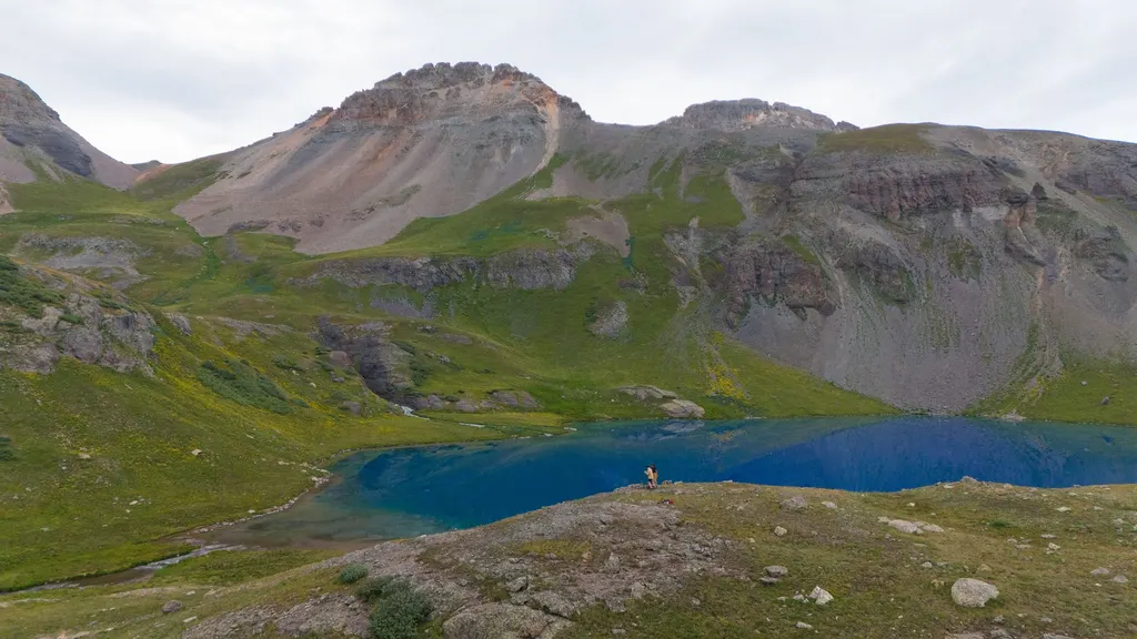
Silverton Jeep tours run on the Alpine Loop, a 4x4-only road that tops out at 12,800 feet and ties Silverton to Lake City and Ouray, per the BLM. Doing the full loop is an all-day trip. In summer, tours and rentals leave straight from town. The one rule that trips people up: you can't ride an OHV or ATV into the Town of Silverton, and the fine is $300. Here's how the routes, tours, rules and season work.
What is the Alpine Loop?
It's a backcountry route, not a scenic drive. The BLM describes a rugged, high-clearance road that links Silverton, Lake City and Ouray, with ghost towns and old mines along the way. From Silverton you enter on County Road 2.
So what makes it a loop? Cinnamon Pass (about 12,640 feet) and Engineer Pass (up to 12,800), with the Animas Forks ghost town sitting between them about twelve miles from Silverton at roughly 11,200 feet. That layout helps you plan: a half day gets you to Animas Forks and back, where you can walk among cabins that lost their roofs but kept their walls, while the full loop eats the whole day and feels like a different kind of driving. Don't count on your phone, because the BLM says it won't work in most areas. Download maps first.
What other routes leave from Silverton?
Silverton sits at the center of a whole network of old mining roads:
- Ophir Pass heads west off US-550 toward Telluride, crossing at about 11,800 feet. It's narrow, and often the first pass people try.
- Stony Pass climbs east out of Howardsville over 12,000 feet toward the Rio Grande headwaters. It's remote.
- County Road 110 to Gladstone runs up the Cement Creek drainage into old mining country north of town.
One thing worth saying plainly: the Million Dollar Highway does not need a Jeep. CDOT says that name belongs to the paved Ouray-to-Silverton stretch of US-550, over 11,018-foot Red Mountain Pass. Plenty of visitors mistake it for a four-wheel-drive route. Drive it in daylight and let the locals pass.
Should you book a guided tour, rent, or bring your own rig?
Three choices, three kinds of traveler.
Guided. A driver who runs these roads daily knows which passes opened this week, and handles the exposure while you look around. Tours also tell the history, like which basin fed which mill. Book ahead in July and August, because the good ones fill.
Rented. Outfitters in Silverton and Ouray rent Jeeps and side-by-sides by the day. You set the pace without hauling your own vehicle over the passes. Read the rental agreement on where you may take the machine, because some routes are off-limits.
Your own vehicle. Cheapest and most flexible, and every consequence is yours. Carry a full-size spare and recovery gear you know how to use. A sliced tire on a shelf road above 12,000 feet, with no service, is the classic San Juan mistake.
What are Silverton's OHV rules?
This surprises people every summer, so read it before you trailer anything. The details come from the town's OHV rules page.
| Question | Answer |
|---|---|
| OHVs in the Town of Silverton? | No. Voters decided on October 12, 2021, not to allow OHVs, ATVs or dirt bikes without a street-legal license |
| Penalty | A $300 fine and/or towing, under Town Resolution 2022-07 |
| OHVs on San Juan County roads? | Only on certain roads. County Resolution 2022-02 allows some, not all |
| Registration | Register with Colorado Parks and Wildlife and display the sticker; carry liability insurance |
| Out-of-state plates? | Colorado doesn't recognize them as street legal for OHVs |
| Street-legal dirt bikes? | Yes, they're the only exception |
The closest access points are on County Road 2, outside town, and on County Road 20, beside the Silverton Lakes Campground. There's no official staging area, and parking is first come, first served. Your rig must be fully off the traffic lane, never on private property.
None of this applies to a licensed, plated Jeep or truck. The ban is about unlicensed machines, not four-wheel drive.
When is the season?
The passes open sometime in late spring and close by late fall, but treat those as edges, not a plan. July through September is the dependable window. Snow can sit on shaded slopes into July, and an early storm can close a pass without warning. Early in the season, a single drift can block the road at the top with no place to turn around. Call a local shop the morning you go, because they were up there yesterday.
What goes wrong up there?
- Altitude. Silverton is already above 9,300 feet, and the passes climb past 12,000. Give day one to something easier.
- Afternoon storms. Thunderstorms build most days in July and August, so aim to be off the high passes by early afternoon.
- No cell service. Tell someone your route and return time, as the BLM advises.
- Shelf-road etiquette. Many stretches are one lane. Uphill traffic generally gets the right of way, and sometimes somebody has to back up.
- Fuel. Nothing sells it out there. Fill the tank in town.
Where should you stay?
Silverton lodging is a short list of small, independent motels in the walkable center, and weekends sell out in summer. Staying in town matters for Jeep trips because a full day on the loop doesn't fit around the 48-mile drive from Durango at both ends.
- Triangle Motel, 848 Greene Street. Pet-friendly, with an accessible room, next to a fuel stop. A handy base for an early start. Ask about trailer parking when you book.
- Prospector Motel, 1015 Greene Street. Central and budget-friendly, an easy walk to dinner after a dusty day.
- Kendall Mountain Lodge, 1025 Blair Street. On historic Blair Street, with mountain-lodge character.
Our Silverton visitor guide covers the town itself, and the motel category lists lodging across the region. Basing in Durango? See where to stay in Durango, the outdoor adventure guide and things to do in Durango. If the high country is the whole reason you're coming, book the Silverton room first. It's the one that runs out.